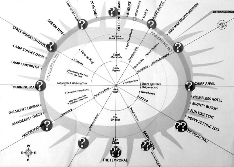
EVENT MAPS
Below in chronological order you’ll find maps of every year of our event that show how the urban plan was first laid down and has grown and changed shape over the years.
What shaped Tankwa Town?
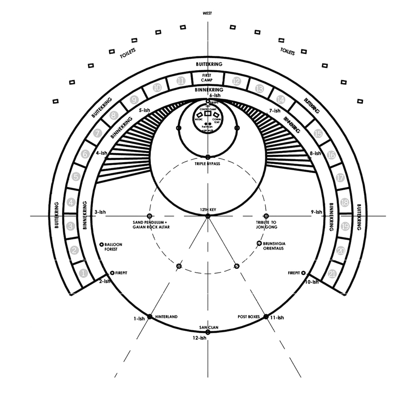
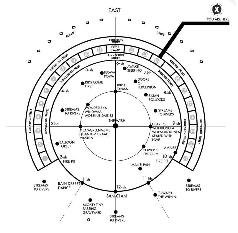
Every year, since 2017, our map has shifted and changed. In the early years, our city was built on the same circular Burning Man model that many burns around the world have adopted – but as Tankwa Town expanded, so the land itself and our interest in leaving as little trace as possible on the landscape has determined what the best areas are for us to settle our temporary city on.
The factors that have shaped our temporary city include placing our event infrastructure on flat sand or gravel pans where the least flora & fauna are found or could be disturbed, and away from seasonal watercourses that are subject to flash flooding. This is why you’ll see that expansions have extended down the length of 10ish (and not in a series of concentric circles). Something else you will notice is that sound areas have moved, and moved again, over the years: this again is all part of the process of adjusting urban planning to take into account the factors that determine what works best.
2006
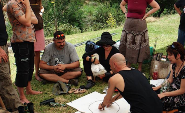
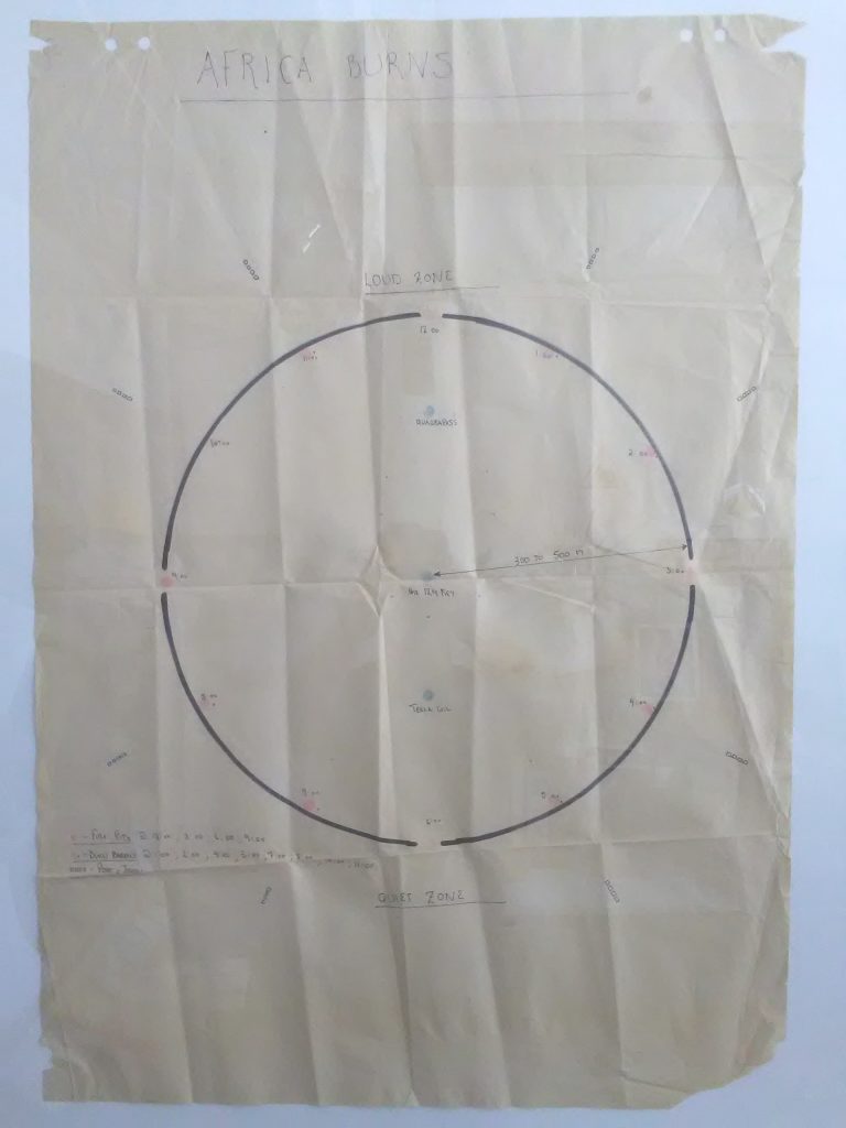
Below is the event placement concept as sketched out at MalPlaas outside Botrivier in 2006 (above), at which early instigators of Afrika Burns as it was called then Paul Jorgensen, Lil Visser, Robert Weinek, Mike T’Sass Rolfe, Monique Schiess, Paul Grose and Richard Bowsher (among others) gathered to plan the first event.
This first event was originally scheduled for late 2006 on a farm at the start of the R355 in the southern Tankwa Karoo. An early build crew were in the process of erecting an artwork, and Paul Jorgensen remained at the location overnight. He awoke after a downpour to find the artwork washed away, and his tent filled with water.
 Paul Jorgensen, landowner Boet, Lil Visser and Robert Weinek.")
With such clear evidence that this would not be a suitable event site, this led to a new location being sought – and the one finally identified was Stonehenge Private Reserve, on which the event has been held since 2007.
The site came to the attention of our early event team thanks to blacksmith and metal artist Conrad Hicks visiting Stonehenge on the recommendation of fellow off-road biker Henk Van Niekerk, who owned the property. He then passed the info on and once the team had visited the suggested site, it was clear that the location and the expanses of gravel and shale on which the least flora or fauna is usually found, would be far more ideal for the uses planned.
Since then, the event map has changed every year, with some big changes over the years 2010 – 2015, when expansion zones were added as our numbers grew. From 2014 onward, the changes have been fewer, and largely limited to tweaking the roads, camping and sound zones to the best effect.
2007
2008
2009
2010
This was the year that Buitekring Road was officially added.
2011
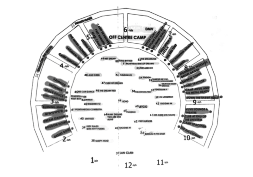
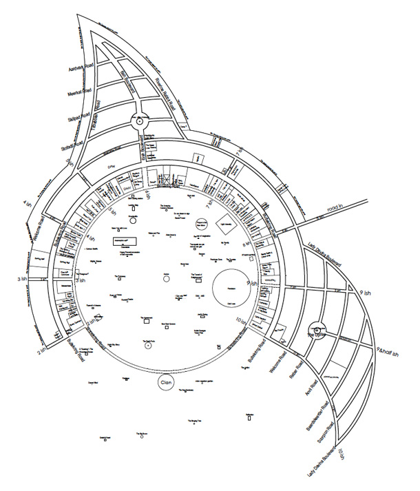
2012
This year marked the first extensions of 10ish street, and the consolidation of the ‘pixie hat’ (seen at top left of this map) camping area into a defined camping zone with its own streets, which until this point had been a loosely-camped DPW / DMV / organisational, crew and veteran campers area.
2013
Further extension of 10ish due to the need for more theme camp spaces saw this year’s grid extended down 10ish, with feeder roads 9:30ish Boulevard and Lady Davina Boulevard being added. In addition, Up Rize Plaza was added, in honour of a longstanding crew member.
2014
Big changes were made in this year:
– Additional camping was opened up beyond 3ish
– The ‘pixie hat’ beyond 6ish was formally defined, with a road added to clearly
demarcate the bush line
– 10ish, 9:30ish Boulevard and Lady Davina were extended to create more frontage for
Theme Camps, and provide greater space for Open camping.
– The Clan site (12ish on the circle) was moved further out
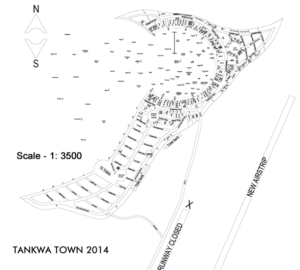
– A feeder road from Welcome to the bottom of 10ish was added
– Our old airstrip was closed (as this was too close to our city) and a new airstrip opened up further away
– Artworks began to move much further out, to prevent compacting the space with in the circle (and provide greater space for mobile sound rigs) as well as provide more safe distance between the camped areas and burning structures
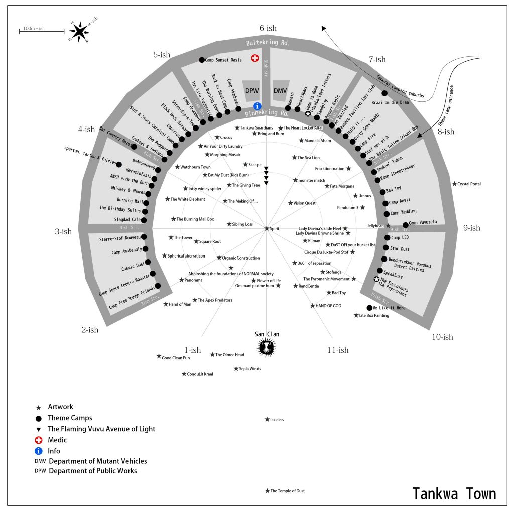
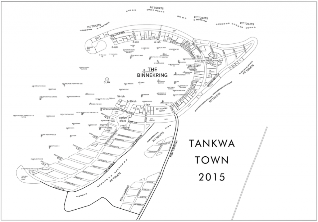
2015
This was the first year that overflow camping areas were opened up alongside Welcome Road. Another addition was the trial of a cul-de-sac at the very end of the arm of 2ish.
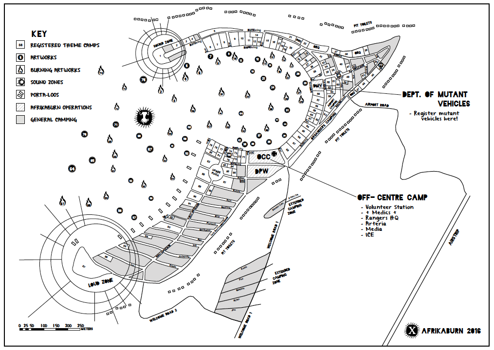
2016
This year the Loud Zones became more defined (shown below as circles at the ends of 2ish and 10ish), and a second extended camping area was added closer to the city along Welcome Road.
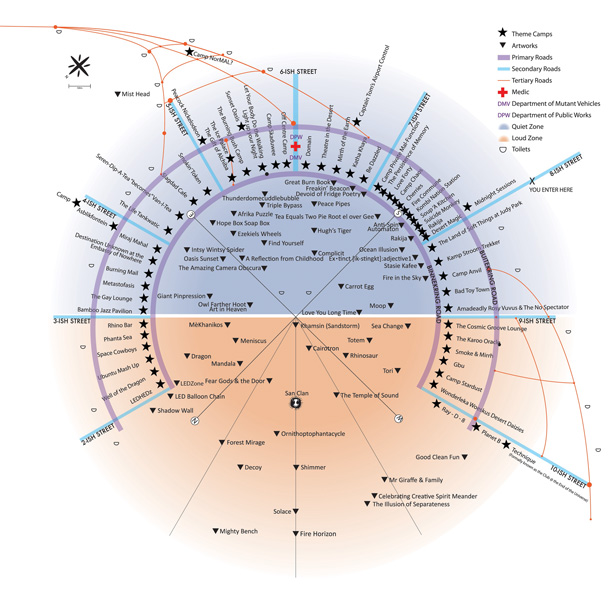
2017
This year, the corner of 10ish and Binnekring was shaved off, opening the circle up to greater visibility and inclusion, effectively expanding the open space that artworks could be placed in, and that mutant vehicles could roam across. This also meant that the old Binnekring circle no longer felt separate from the increasingly-used space beyond it.
New additions:
– Walk-In Camping (above and beyond 6ish to 4ish)
– Extended camping areas were expanded to include The Island (the teardrop-shaped area at middle right of this map that straddles Welcome Road). This has become DPW’s crew and workyard location as it remains relatively unflooded, even during heavy downpours.

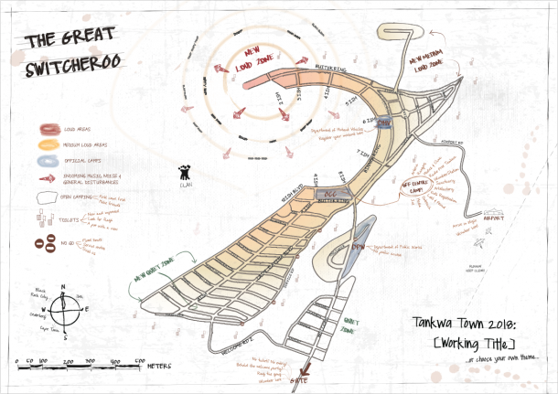
2018

This was the year of the Great Switcheroo. Wait – what the hell was the Switcheroo? This year, in the name of experimentation and urban planning, we switched the sound zones around, concentrating them solely along the strip of 2ish, and beyond. This changed the soundscape of our city – and worked very well.
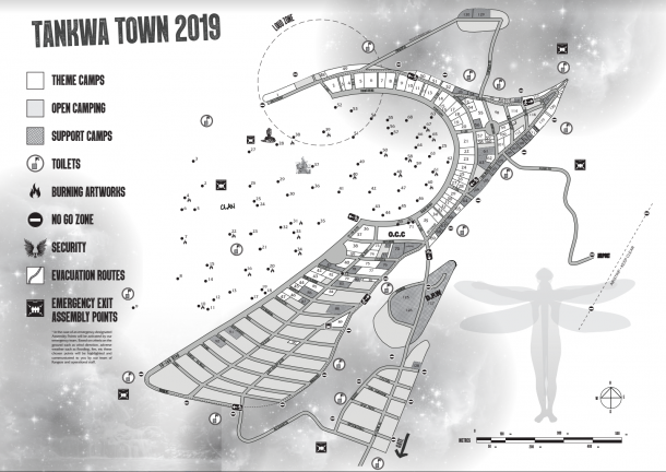
2019
Every year in January our team starts the complex process of placing registered theme camps, artworks, crew infrastructure and the many crew camps and support camps (which house Collectives) – and that process continues right up until mid-April, by which time our WTF Guide and map are finalised. Come back here then to view the latest map (or watch our channels for the release of the year map closer to our event date).