EVENT GUIDE
Tankwa Town: a blank canvas which, for 11 months of the year, is a beautiful Karoo gravel plain where the surrounding veldt is home to myriad small critters and a wonderful array of indigenous flora. And then, at the end of April, a town erupts: a town that’s your home for a brief period, and is then restored to its previous condition – by you.
Even though the content of all theme camps, artworks and activities are self-organised by our wildly energetic and creative community, Tankwa Town requires a large amount of planning and organisation in order to fit it all together.
Thank you to everyone who registered a camp, artwork, performance or mutant vehicle – all of it adds up to the magic of the experience. To get your bearings and locate the many offerings that this year’s event will offer, take a good look and familiarise yourself with the layout. There’s something for everyone out there on that beautiful flat plain, which, for just a short period every year, becomes a wonderful town where the possibilities are endless.
WTF GUIDE 2019
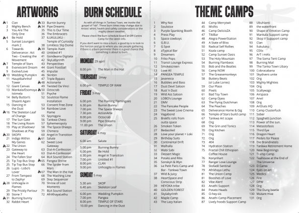
It’s here – and it’s packed with all the info you need to navigate your experience in the dust. Many thanks to designers Rachel Smith and Lizl Scmuhl, who knocked it out the park this time round.
To download your PDF copy of the WTF Guide, click the image of the guide cover below – and for copies of the front & back of the map, click those images below. 
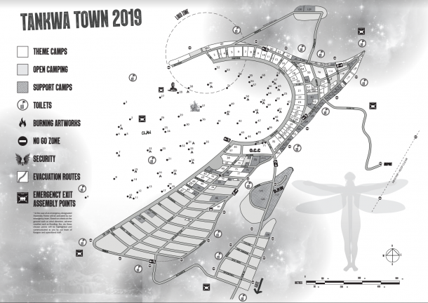
This year’s map is much the same as 2018’s, with one major change – this time round, due to changes in event permit requirements, and because (after a serious thunderstorm in 2012) we’re advised by local farmers that the 7-year wet cycle may land this year, we’ve included Mass Incident advisory info on the map. If a serious thunderstorm hits, and also if a fire breaks out in a camping area that becomes a serious matter, this info will provide you with clear ways to move to safe locations whilst our teams assist.
Many thanks to this year’s map designer, Sue Guldemond, for her work on helping our community navigate the dust this year!
WTF 2018
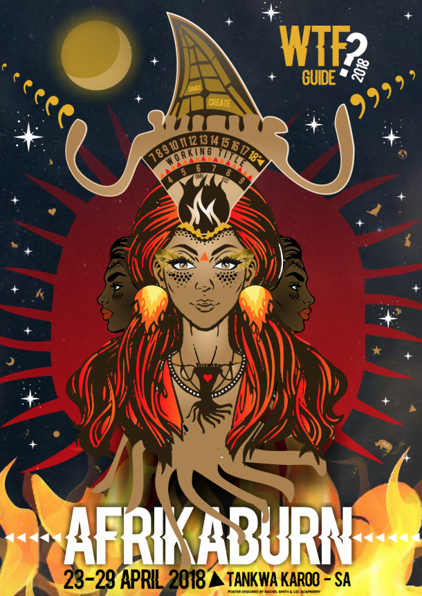
As you can see, she’s a real beauty. Massive thanks to volunteer designers Rachel Smith and Lizl Schmuhl for their amazing work this year’s WTF! Tuck in, and prepare to experience its contents in real life in the dust.
TANKWA TOWN 2018
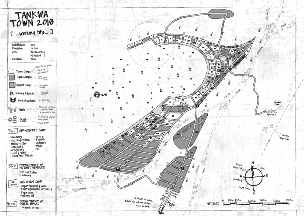
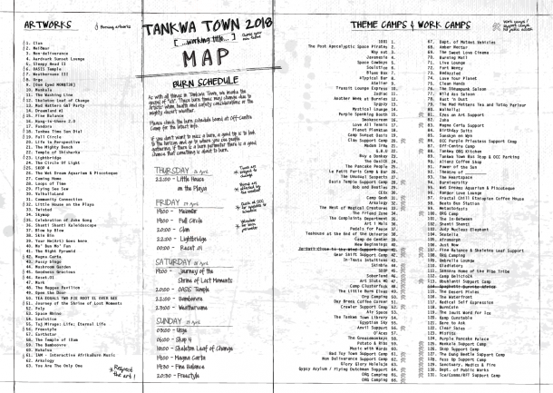
Here it is folks – your final and complete 2018 WTF Guide Map, which lists all registered projects’ locations, and also all event services and important landmarks!
Click either of these images below to show the zoomable & downloadable hi-res PDF. And don’t forget – before you print yours out and slay some much-needed trees in the process – you can pick up your copies at our event gate, Die Hek, on arrival (or at Off-Centre Camp).
Massive thanks to volunteer designer Claire Du Plessis for her amazing work on creating this year’s map!
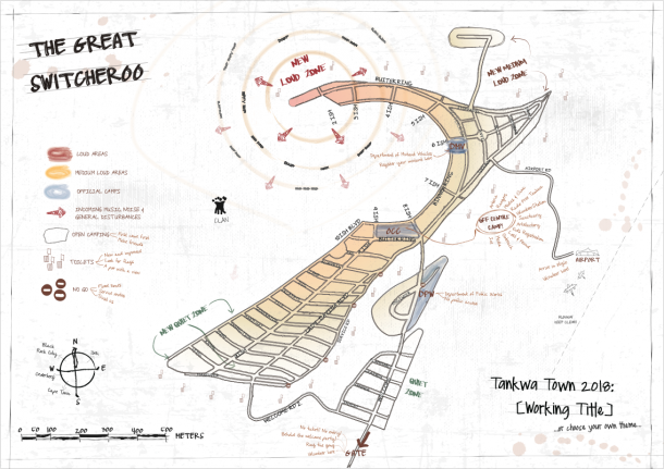
So, what’s new? Ah – this is the year of the Great Switcheroo!
But wait – what the hell is the Switcheroo? This year, in the name of experimentation and urban planning, we’re switching the use of Tankwa Town around. The Town layout will remain the same, but the use of the space is going to change. To sum it up: we’re switching the sound zones around.
What are the reasons for this?
• Since Tankwa Town first rose from the dust in 2007, there has always been a high demand for quiet camping.
• We’ve been having curatorial headaches with quiet and reflective spaces wanting to be places far out – yet at the same time we need to put loud systems far out to get them away from camping.
• Placing large sound systems near to the largest camping areas isn’t working, as this means lots of people don’t want to camp in these areas.
• So the solution – the Switcheroo – is to put the loud zone in the area of our Town that has the least camping space available.
• So it makes sense to place the loud camps and installations in the area that has less camping space available. ie: the 2-ish area.
• This also enables us to make the Binnekring come alive at night, instead of being a dark area.
So, if you’re a territorial Tankwatonian and very attached to “your” spot at Tankwa Town, you’re going to have to be brave and roll with it. You can always stay in “your favourite spot” (if it’s available) – but it just may be in a different curatorial zone. Bear in mind that the movement of large sound rigs away is limited to only the 2ish area: if you’re camped at 6ish, or further away, chances are good sound levels won’t affect you, because sound rigs will be placed facing outward, away from our city (and away from you).
Take a look at the map below to get a sense of how this will change the soundscape of our city – and click on the map if you want to check out the larger downloadable PDF version.
Massive thanks to The NowNow Tribe’s Claire Du Plessis for volunteering her time & skills on the map you see above. Sit tight for our 2018 Survival Guide, and more, coming soon.
TANKWA TOWN 2017
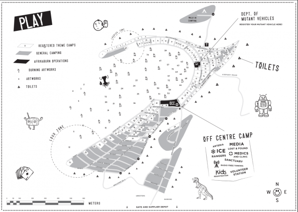
Here’s our city map for 2017 – this is the same map you’ll find in this past year’s WTF Guide. Click the image for the large PDF version.
As you can see, we’ve made some small adjustments: the corner of 10ish, which once extended far out enough to create the sense of two separate spaces, has been trimmed. This makes our entire ‘inner’ space, which is where almost all Artworks are placed, now one big open space.
Camping at the lower portions of 10ish Boulevarde has also been expanded – and we’ve added a new area: Walk-In Camping, which is beyond 4ish. If you arrive later in the week and need a campsite, park your car (in the parking area next to the gate area) and hitch a ride into the city to get to Walk-In Camping. It’s a great space if you want quiet, as there’ll be no generators, sound systems or vehicles. As always, the lay of the land, and watercourses, dictate where we can safely camp and have event activities – as with everything in the desert, Mother Nature calls the shots. This is why there are signs stating ‘NO CAMPING BEYOND THIS POINT’.
Want a copy of this year’s WTF Guide? Here you go – click the image to read or download the PDF version.
Many thanks to everyone involved in creating this year’s WTF Guide – especially designer Jeanne Fourie, and mapmaker Guillaume Vagrante, as well as all our Wranglers who assisted in compiling the listings content.
In 2017, we were very happy to finally have our Survival Guide available in English, Afrikaans – and isiXhosa! To read & download the Guide in the language that suits you best, click that cover here:
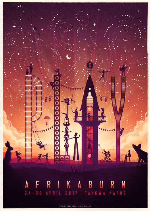
Looking for the 2017 poster? Here you go (click the image for a large downloadable PDF version):
2016
Check out our 2016 WTF Guide here (or click the image to browse / download):
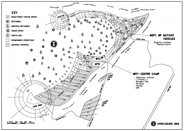
Click on the map to view the zoomable PDF version (or download it).
Our town, over the years, has grown into a city. If you’d like to check out the progression over the years, scroll down.
2015
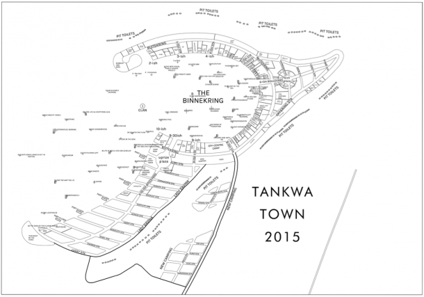
Below is what our city looked like in 2015.
– WTF Guide
– Survival Guide
– Event poster
2014
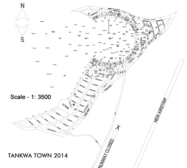
– WTF Guide
– Survival Guide
– Event poster
2013
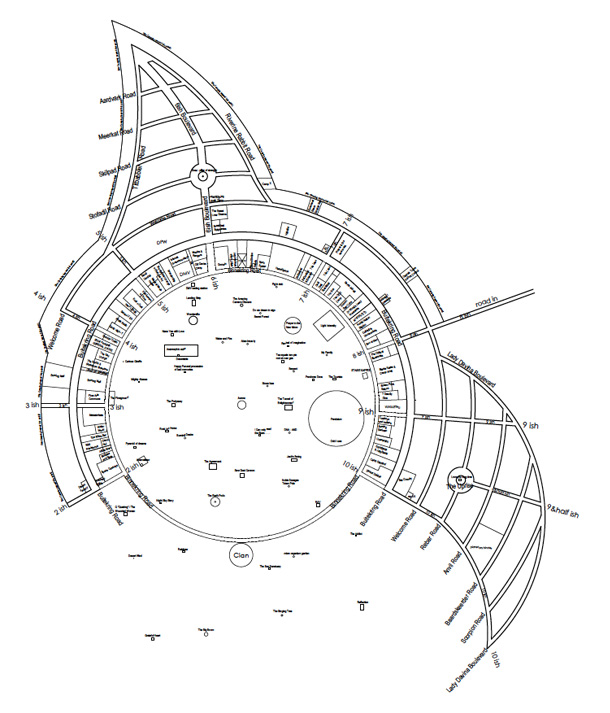
– Event Guide
– Survival Guide
– Event poster
2012
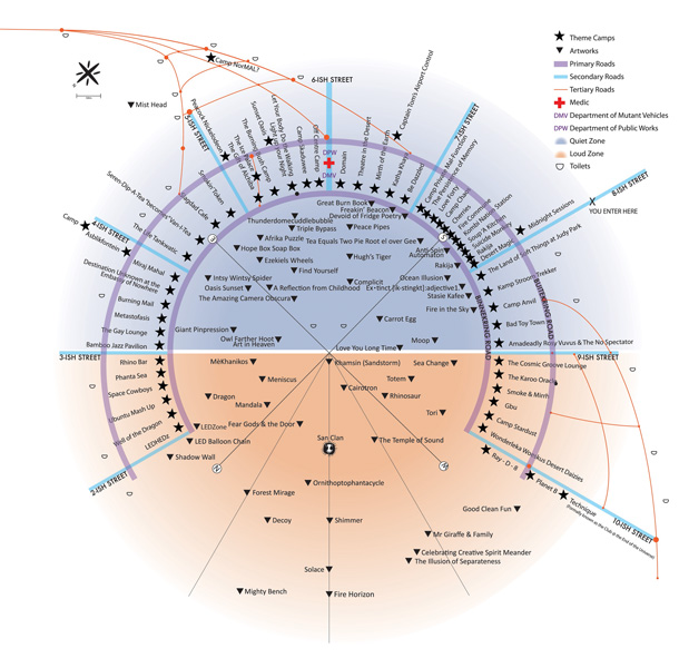
2012’s event documents:
– Event Guide (front, back)
– Survival Guide
– (there was no poster this year)
2011
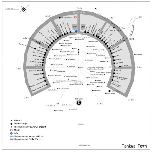
– Event Guide (back, front)
– Survival Guide
– Poster
– A snippet of our old website, shared as a PDF
2010
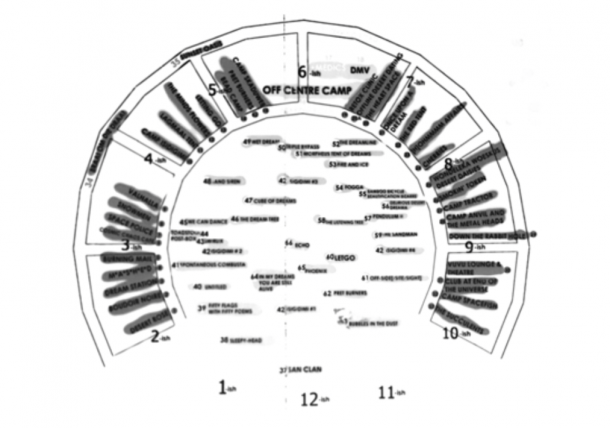
– Event Guide
– Survival Guide
– Poster
2009
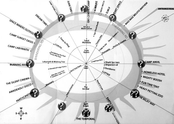
– Event Guide
– Survival Guide
– Poster
2008
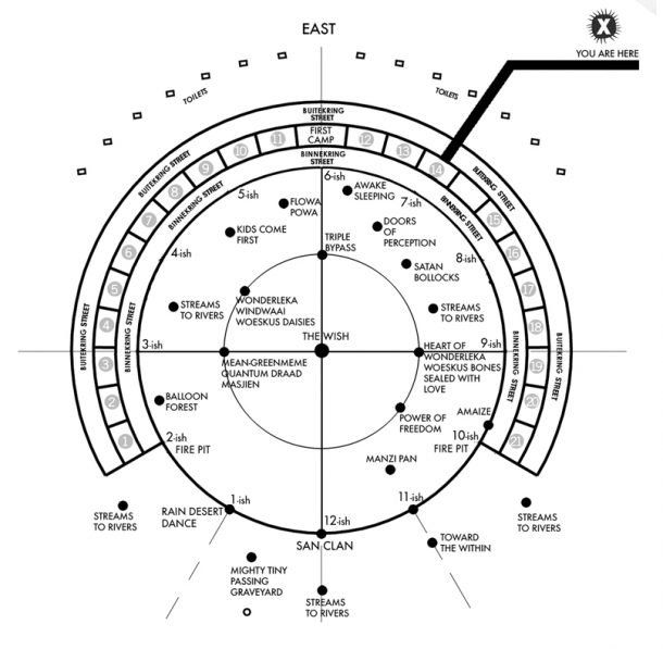
– Event Guide (inside, outside)
– Survival Guide (was on the early afrikaburns.com website)
– Poster
2007
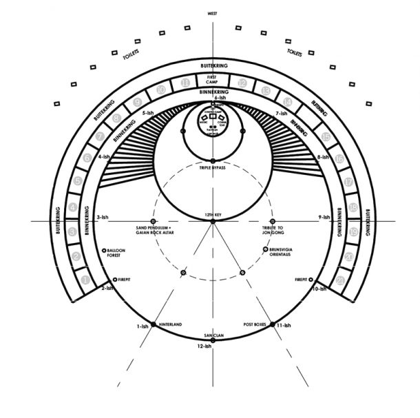
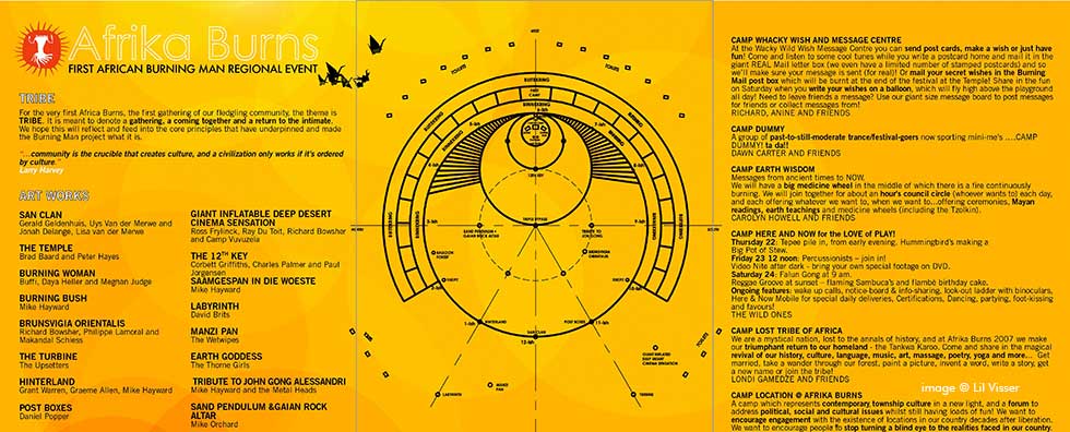
– Event Guide (inside, outside)
– Survival Guide
– Poster
2006
This is the pre-event plan as sketched out at a planning session in 2006.
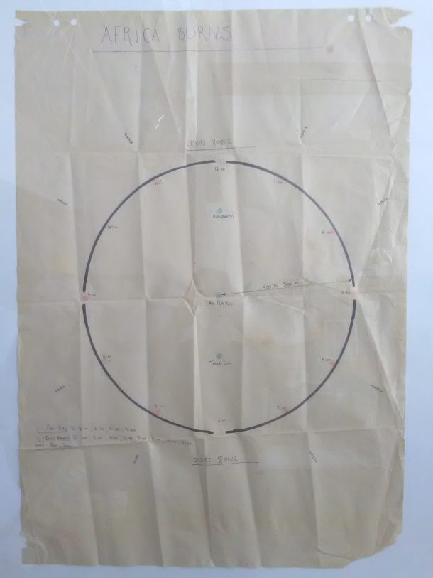
There are still some items missing here (they’ll be added here as soon as we dust off some very old hard drives and jog some dusty memories).
Interested in the history of our city? See the numbers by year, and theme, here. And, if you’d like to know who did what, and when, you can see that here.

